|
|
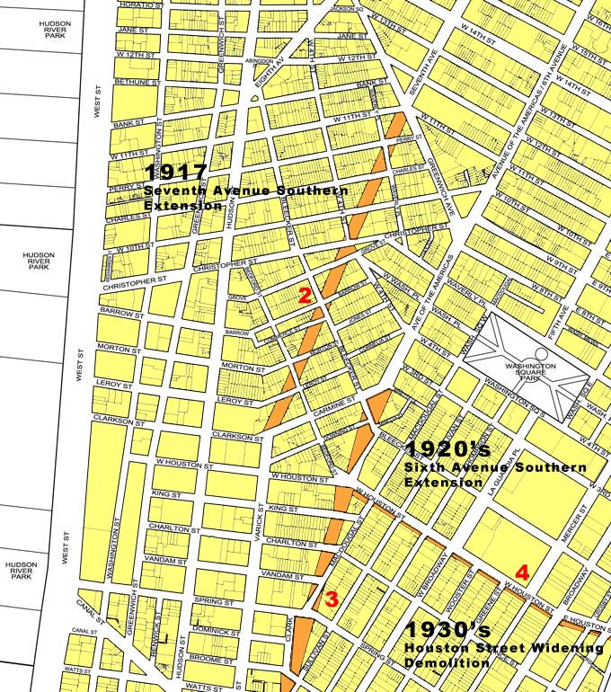
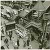
Greenwich Village and SoHo Historic Streets and Layouts:
The above map illustrates some of the major changes that have occurred to the streets and street layouts in Greenwich Village and SoHo over the last hundred years. Due to a variety of expansion projects, a few of which are highlighted here, the area has been changed dramatically, but still maintains a village atmosphere due to the perseverance of the preservation movement which was able to halt fother planned developments and expansions.
|
 |
1. 1890's, Prior to 1900's Expansions
When New York City adopted the city street grid plan in 1811, Greenwich Village maintained its existing pattern of streets mainly because it had been isolated from the rest of the city. In the late 1800's the street layout was much the same as it was in the late 1700s and the early 1800s with meandering narrow streets better suited for foot traffic than for the automobiles quickly becoming popular.
|
 |
2. 1917, 7th Avenue Southern Extension
In 1917 in order to coincide with the construction of the IRT Subway running underground, 7th Avenue was extended south of Carmine Street (where it previously ended) to join Varick Street. In order to have the two avenues meet, the new extension had to cut at an angle to the existing street grid, and resulted in the demolition, and partial demolition of many structures, and a variety of left over wedge shaped spaces. The southern extension of 7th Avenue did not modify the house numbering system, as the southern portion was named 7th Avenue South and initiated its own numbering.
|
 |
3. 1920's, 6th Avenue Southern Expansion
In the late 1920' 6th Avenue was extended to the south below Carmine Street, where it previously ended. This southern extension to 6th Avenue resulted in the demolition and partial demolition of many buildings along its route and the creation of many open and unbuildable spaces along the avenue extension. In the mid-1970's, the City of New York decided to use these small left over wedge shaped spaces and design small vest-pocket parks and public seating areas. In the late 1990's, several of these parklets around Minetta and Downing Streets were renovated with a historical style to harken back to the late 1800's.
|
 |
4. 1930's, Houston Street Widening
In the 1930's Houston Street was increased in width to accommodate six lanes of traffic, three in each direction. Houston Street was widened when the IND subway was being constructed underneath it. The original Houston Street was similar to the cobble stone stretch that remains at West Houston, west of 6th Avenue. In the 1960s, a third street, to be named Verrazano Street, was due to be cut through to 7th Avenue South, but the plan was defeated. In order to accommodate the two significant structures along Houston Street, the Cable Building and the Puck Building, Houston Street was widened by tearing down houses on its south side between Sixth Avenue and Lafayette Street, but then on its north side between Lafayette Street and Avenue D.
|
|
|
|
|
|
|
|